
The Global Positioning System (GPS) is a satellite-based navigation system that provides pinpoint accuracy. The core components of a global positioning system (GPS) are a network of satellites and sophisticated equipment like a receiver. But the satellite constellation needs to have at least four components. A precise atomic clock is built into both the satellite and the receiver. Timekeeping on the satellites and on the ground are perfectly in sync with one another. The GPS receiver’s internal clock is not synchronized and therefore less accurate. Daily adjustments should be made to account for any time difference between the satellites and the earth’s clock. From the synchronized satellite network and the receiver, four unknown parameters (three coordinates and clock variation from satellite time) must be calculated. The job of the GPS receiver is to collect signals from the constellation of satellites and solve for three time and location variables that are unknown to the user.
The time and location of the transmitting satellite are transmitted alongside pseudorandom codes in a GPS signal. Carrier frequency modulation is another name for the signal that GPS transmits. A series of ones and zeros is an example of a pseudorandom code. In practice, the navigation equations used to analyze time of flight (TOFs) are used to simultaneously compute the receiver position and the offset of the receiver clock relative to the receiver system time. The time of flight (TOF) consists of four numbers calculated by the receiver based on the signal’s time of arrival and the time it was sent. Latitude, longitude, and elevation above sea level (or geoids) are the standard outputs. The locations are then shown on the screen.
Elements of GPS
The Global Positioning System has a convoluted design. A space segment, a control segment, and a user segment make up its three primary parts. It’s a lot of work to get the satellite into a medium Earth orbit. Twenty-four to thirty-two satellites or spacecraft, spread across three concentric orbits, make up the space section. Almost location on Earth has a clear view of at least six satellites at any given time.
The control section comes right after the space one. The control segment consists of the MCS, the AMS, the ground antennae, and the monitoring station. Thousands of civilian, business, and military positioning services make up the user base. An antenna, set to the correct frequency broadcast by the satellites, is the heart of any GPS receiver or device. There is a screen that shows the current time and location.
The number of channels a GPS receiver has determines its ability to track a certain number of satellites at once. Typically, a receiver will have between four and five channels, but technological advances have allowed for even more.
Satellite broadcasting frequencies are all frequencies used by satellites. There are five different kinds of frequencies in this range: L1, L2, L3, L4, and L5. These vary from 1176 MHz to 1600 MHz in frequency.
How GPS works
Each GPS satellite completes two rotations around the Earth per day. It orbits the Earth at a precise perihelion distance and transmits data and signals back to the surface. GPS receivers collect all of this data and utilize triangulation to pinpoint the user’s precise location. A GPS receiver just compares the time it took for a signal to travel from a satellite and the time it took to reach the ground. The GPS receiver’s distance from the satellites is calculated using the time difference. Using a larger number of satellites and the receiver’s calculations, the electronic device may pinpoint the user’s exact location and show it on a map.
If you want your receiver to output a two-dimensional position and follow your movements, you’ll need to lock onto the signal from at least three satellites. Using four or more satellites, the receiver can pinpoint the user’s exact altitude, latitude, and longitude in three dimensions. The GPS device determines the user’s location and then uses that data to determine additional variables such as velocity, direction, track, distance, destination, and even the time of sunrise and sunset.
How accurate is GPS?
The parallel multi channel nature of GPS receivers makes them exceptionally precise. Although atmospheric noise and disturbances can occasionally perturb and decrease the accuracy of GPS receivers at large, the parallel channels are highly rapid and precise.
Differential GPS (DGPS) users additionally benefit from greater precision thanks to a correction of GPS signals to within a range of three to five meters. The most widely used DGPS correction service is run by the United States Coast Guard. An array of towers in this system receives satellite positioning system transmissions and relays the precise signal via beacon transmitters. Users, in addition to a GPS, will need a differential beacon receiver and a beacon antenna to pick up the correct signal.
Sources of GPS signal errors
The following are examples of factors that can compromise the accuracy of GPS signals:
- Ionosphere and troposphere delays – Due to attenuation by the atmosphere, satellite signals take longer to reach their destinations. To account for this type of error, the GPS system has an in-built model that determines the typical time delay needed to make up for it.
- Signal multipath– Whenever the signal is reflected from larger objects like buildings or rocks before it reaches the receiver, a mistake occurs. This leads to inaccuracies and delays in the sent signal as a whole.
- Orbital errors – These errors are also known as ephemeris errors which are used to calculate the inaccuracies of the location of the satellite.
- Number of satellites visible– A GPS receiver’s precision is directly proportional to the number of satellites it is able to track. There can be errors in position and sometimes no reading at all because to things like buildings, terrain, and electronic interference. It has a poor track record of performance in enclosed spaces, at sea, or below ground.
Applications
A GPS device is well-known for its military applications, but it also has several civilian and industrial uses. Examples of civilian uses include:
1. Astronomy: Used in Astrometry and celestial mechanics calculations.
2. Automated vehicles: It is also used in automated vehicles (driverless vehicles) to apply locations for cars and trucks.
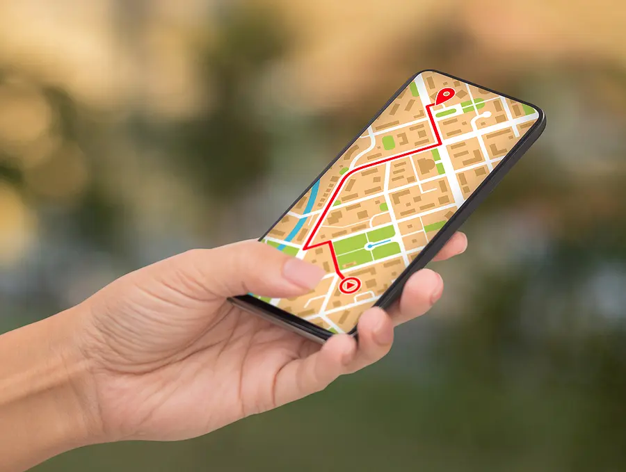
3. Cellular telephony: GPS tracking software is built into most modern smartphones. Being able to pinpoint one’s exact location and monitor the proximity of useful services like banks, cafes, police stations, and more is why it exists. The first GPS-enabled mobile phone debuted in the 1990s. It has various uses in the field of cellular telephony, including the detection of urgent phone calls.
4. Disaster relief and other emergency services: In case of any natural disaster, a GPS is a best tool to identify the location. Even prior to the disasters like cyclones, GPS helps in calculating the estimated time.
5. Fleet tracking: GPS is a developer tool known for its potential to track military ships during the war time.
6. Car location: A GPS enabled car makes it easier to track its location.
7. Geo fencing: In geo fencing, we use GPS to track a human, an animal or a car. The devise is attached to the vehicle, person or on animal’s collar. It provides continuous tracking and updating.
8. Geo tagging: one of the major applications is geotagging meaning applying local coordinates to digital objects.
9. GPS for mining: Uses centimetre-level positioning accuracy.
10. GPS tours: helps in determining location of nearby point of interests.
11. Surveying: Surveyors make use of Global Positioning System to plot maps.